33-Rai Land on Highway 12, Yang Talat, with Expropriation Corridor
55 views13,331 sq.wah
Land area
1
Plots
Vacant land
No structures
Price
Average ฿2,538/sq.wah
Land details
Vacant land under title deed no. 26614 in Yang Talat Subdistrict and District, Kalasin. The single title covers 33 rai 1 ngan 31 sq.wah, or 13,331 sq.wah (53,324 sq.m.), and fronts Khon Kaen-Yang Talat Highway 12 and KS.3037. SAM publishes THB 2,538 per sq.wah and shows white zoning with a green border and diagonal lines.
The polygonal property fronts two roads: approximately 328 metres on the south along Highway 12 and approximately 227 metres on the east along KS.3037. Another boundary adjoins a public watercourse. The summary gives maximum depth as 227 metres, while the detailed text states approximately 230 metres to the watercourse. Buyers must verify the title, survey, shape, boundaries, dimensions, public watercourse, markers and access from both roads before offering.
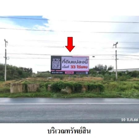
Land level is approximately one metre below the road, so fill, drainage, flooding and road-connection costs require assessment. Highway 12 is described as a public asphalt road approximately twelve metres wide within a forty-metre right of way. The source plan labels KS.3037 as an approximately six-metre asphalt road, but the detailed text does not publish its legal status or right-of-way width. Verify highway access permissions, turning arrangements, both rights of way and every entrance.
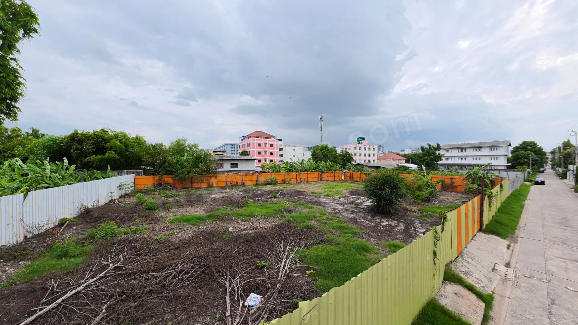
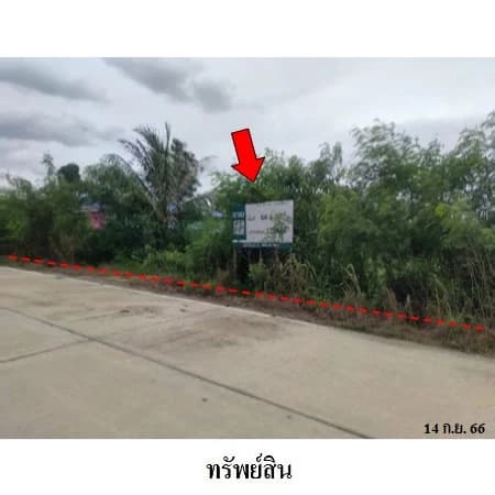
Source property photos display 20 September 2022, 19 June 2023 and 15 December 2023, and conditions may have changed. The source does not publish utilities, possession, flood history, soil information or other encumbrances. Administrator coordinates are approximately 79.4 metres from SAM's rounded coordinates. Since this is a large plot, both points may be within it, but an online pin must not replace a cadastral survey. Buyers should inspect and verify every current condition before deciding.
Property notes
Most important caveat: SAM reports that approximately 1 rai 3 ngan 25 sq.wah, or 725 sq.wah (2,900 sq.m., about 5.44% of the total area), lies within an expropriation corridor under a 2019 Royal Decree for the Yang Talat rural-road bypass. This wording does not mean acquisition is complete. Buyers must confirm the latest alignment, acquisition stage, affected area, compensation amount and entitlement, effect on access and usable remaining land with SAM, the Land Office and the acquiring authority.
SAM describes residential and agricultural surroundings. MapxProp therefore places the land in homes discovery with residential and agricultural use cases, not mixed use or business. This is not approval for subdivision, construction, industrial or agricultural development. Buyers must verify the white-with-green-border-and-diagonal zoning rules, subdivision controls, public-watercourse setbacks, the expropriation corridor, environmental requirements, utilities and all permits.
Price and contact
The SAM page listed the property for direct purchase at an announced THB 33,835,000 when checked on 10 September 2026. It was not shown as an auction. Contact SAM directly to confirm availability, current price, offer procedures, expropriation details, costs, possession and latest terms. SAM Sales: 02-686-1888; Call Center: 1443; LINE: @samline. Property ID: 4T0923. MapxProp does not collect deposits or represent SAM.
Location and directions
Yang Talat · Kalasin
Vacant land, title deed no. 26614 Fronting Khon Kaen-Yang Talat Highway 12 and KS.3037
Nearby places
- Khon Kaen-Yang Talat Highway 12
- Kalasin Rural Road KS.3037
- Public watercourse
- Wat Pathum Khongkha
- Yang Talat Subdistrict Administrative Organization
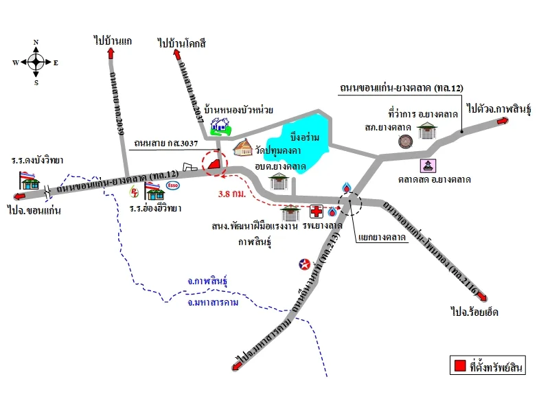 Location map supplied by the advertiser
More location information
Nearby places named by SAM include Wat Pathum Khongkha, the Yang Talat Subdistrict Administrative Organization, Kalasin Skill Development Office and Yang Talat Hospital. Directions use Highway 12 from Roi Et toward Khon Kaen; from Yang Talat Intersection continue approximately 3.8 kilometres and the property is on the right. SAM also identifies nearby assets 4T0921 and 4T0922.
Costs and conditions
- Sale method Direct purchase from SAM — contact SAM to submit an offer
- Announced sale price THB 33,835,000, approximately THB 2,538 per sq.wah — confirm the latest price with SAM
- Title and land area One title deed, no. 26614, covering 33 rai 1 ngan 31 sq.wah (53,324 sq.m.)
- Part of the land lies in an expropriation corridor SAM reports approximately 1 rai 3 ngan 25 sq.wah (2,900 sq.m., about 5.44%) within the Yang Talat bypass expropriation corridor under a 2019 Royal Decree; verify the latest corridor, stage, compensation, entitlement and remaining land
- Two road frontages Approximately 328 metres of southern frontage on Highway 12 and 227 metres of eastern frontage on KS.3037
- Khon Kaen-Yang Talat Highway Highway 12 is described as a public asphalt road approximately twelve metres wide within a forty-metre right of way
- Depth and public watercourse The summary gives a maximum depth of 227 metres while the detail states approximately 230 metres to the public watercourse; survey and verify watercourse setbacks
- Land level and zoning Land is approximately one metre below the road in white zoning with a green border and diagonal lines; verify fill, drainage, flooding and permitted use
- Buyer due diligence Confirm the title, survey, expropriation corridor, compensation, remaining land, watercourse, boundaries, both roads, access, land level, zoning, utilities, possession, encumbrances and latest terms
Contact advertiser
Verified organizationSales and Sales Promotion Department — SAM
SAM Sukhumvit Asset Management